Understanding planning · 13 min read
Planning application documents: what to read first
Understand planning application documents, officer reports and decision notices. Use a reading checklist, document table and worked example to inspect a case.
 PlanningTrack
England · Local authority
PlanningTrack collects planning applications and decisions from the public planning register of Wychavon District Council. Search an address, application reference or proposal. Official Wychavon website
58,204 approved · 9,825 refused · 4,901 withdrawn. Received dates in our records: 27 Aug 1978 to 11 Nov 2026. Most recent record check: 16 Nov 2026. Counts reflect the last collected status; some records may be out of date.
We haven’t verified direct planning guidance links for this authority yet. Use its official website in Council sources.
Explore published planning boundaries and follow their source records for designation details. Coverage varies: an empty map does not mean there are no restrictions. Check the council’s current maps and documents before relying on a boundary.
Interactive planning map loads with JavaScript. Dataset sources are linked below.
Download Article 4 coverage for all authorities (CSV)
Data downloaded 14 Sept 2026. Display boundaries are simplified and indicative. Map record counts are not a complete count of designations or directions.
Sources: Planning Data conservation areas and Article 4 direction areas. Contains public sector information licensed under the Open Government Licence v3.0.
Wyre Piddle Village Hall, Worcester Road, Wyre Piddle, Pershore, WR10 2JB
Received 1 Oct 2009Flat 2, Bevere House, Bevere Green, Bevere, Worcester, WR3 7RG
Received 20 Feb 2002Long Barn, Friday Street, Pebworth, CV37 8XW
Received 27 Oct 2006Site 26 Egghill Berry Hill Industrial Estate Droitwich Spa WR9 9AW
Received 13 Jun 2025Beacon View, Netherwood Lane, Crowle, Worcester, WR7 4AB
Received 28 Sept 20150 Millennium Way, Evesham
Received 10 Nov 2009Fairlands, School Lane, Wick
Received 5 Aug 1991Hadley Farm, Droitwich Road, Ombersley, Droitwich Spa, WR9 0AT
Received 29 Nov 2012Stone Cottage, Church Lane, South Littleton
Received 26 Apr 1990Clareland Lincomb Lane Lincomb Hartlebury Worcestershire DY13 9RQ
Received 6 Jul 2022Cookhill Priory, 66 Evesham Road, Cookhill, Alcester, B49 5LN
Received 13 Dec 2004Corner of Millridge Way, Hartlebury
Received 14 Jun 1988Christmas Pastures Droitwich Road Hanbury
Received 27 Jul 2017Land Off, Village Street, Aldington
Received 15 Oct 201228 Stone Pippin Orchard Badsey Evesham WR11 7AA
Received 27 Jan 2022Park Field Feckenham Road Hanbury Bromsgrove B60 4DH
Received 14 Jan 2026The Cross House, Village Street, Harvington
Received 16 Sept 1991Land at, Manor Farm, Hadzor, Droitwich, WR9 7DR
Received 22 Aug 2002Rous Lench Court, Rous Lench, Evesham, WR11 4UJ
Received 28 Sept 201618 Stratford Road, Honeybourne, Evesham, WR11 5PP
Received 29 May 2002Land At Almonry Close Pershore
Received 23 Mar 2022Oxton Organics, Broadway Lane, Fladbury
Received 20 Aug 1990Orchard Farm Cheltenham Road Sedgeberrow Evesham WR11 7UL
Received 28 Jan 2021Hunt Green Farm, Hadley, Ombersley
Received 31 Aug 1988Records are ordered by application ID, not submission date. Use search to find a particular address or proposal.
View all applicationsArea alerts send a daily or weekly email with new applications and decisions near a postcode, filtered by project type. £29 a month, up to 3 areas. Records are limited to the councils we collect.
Set up an area alertStart with the address or application reference. Open a record to read the proposal, dates and available documents, then check the official register for the latest plans and consultation details. If nothing appears, check coverage before treating the result as a complete planning history.
How to search planning applications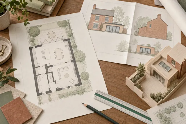
Understanding planning · 13 min read
Understand planning application documents, officer reports and decision notices. Use a reading checklist, document table and worked example to inspect a case.
Understanding planning · 13 min read
Read planning drawings, floor plans, elevations and sections. Use labelled diagrams, a drawing comparison table and revision checks to understand a proposal.
Property research · 13 min read
Understand planning approval rates with an interactive calculator, worked examples and comparison table. Check sample sizes, outcomes and coverage before comparing.
These figures describe applications collected by PlanningTrack for Wychavon District Council, across all dates currently available. They are a partial dataset, rather than an authority-wide performance measure. The date range does not establish continuous historical coverage.
The approval percentage is approved records divided by approved plus refused records. Pending, withdrawn and unknown outcomes are excluded. No percentage is shown until there is an approved or refused record.
Check collection coverage